Wow! The Blizzard of Izard!
Three snows in just over a month's time? Winter in the Ozarks is great...especially when it snows...but, dang-it! Springtime has to be just around the corner!
Despite our longing for the colors of Spring, we couldn't resist gathering a few more clips while out admiring the hills adorned in white!
Enjoy the Video!
Showing posts with label Strawberry River. Show all posts
Showing posts with label Strawberry River. Show all posts
Thursday, February 11, 2010
Wednesday, September 10, 2008
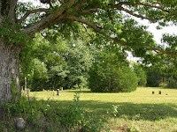
Hill's Chapel Cemetery (Franklin)
On a lonely backroad just outside of Franklin near the old Military Road lies the Hill's Chapel Cemetery. An early politician in the county, Lewis Williams lies here. Apparently, Lewis was also a 1st Lieutenent with Freeman's Regiment during the War between the States.
Also at rest in this place is George Burns, who has family ties to the Lewis Williams family (scroll down on the first Lewis Williams link for Burns' info).
Also buried here are members of the Billingsley, Love, Davidson, and Berry families who were instrumental in the development of the area.


Also at rest in this place is George Burns, who has family ties to the Lewis Williams family (scroll down on the first Lewis Williams link for Burns' info).
Also buried here are members of the Billingsley, Love, Davidson, and Berry families who were instrumental in the development of the area.


Tuesday, July 29, 2008
Spring Hill School and Cemetery
On a whim, we lit out on an unfamiliar backroad this past Saturday and found the old Schoolhouse at Spring Hill. The stone in the building appears to have come from the same quarry (or pasture) as those used in the construction of the old Agri-Building at Violet Hill.
Across the road from the old school is the Spring Hill Cemetery where the family plots of Yanceys, Couches, Cliffts, Browns, and Wisemans can be found. There are two ex-confederates buried here...one a member of the 5th Arkansas Cavalry. Unlike names found at other cemeteries recently, we have been unable to dig up any info on any of the names found at Spring Hill.


Across the road from the old school is the Spring Hill Cemetery where the family plots of Yanceys, Couches, Cliffts, Browns, and Wisemans can be found. There are two ex-confederates buried here...one a member of the 5th Arkansas Cavalry. Unlike names found at other cemeteries recently, we have been unable to dig up any info on any of the names found at Spring Hill.


Friday, March 07, 2008


Wednesday, February 06, 2008
Tornado Alley!
Devastation took place in the county last night on the winds of a fierce and terrible "cyclone"! These shots were taken along the path of a tornado that swept through Izard County last night that claimed the lives of two precious individuals and destroyed the homes of many more. The tornado bounced and staggered back and forth along the winding Zion Road for over 7 miles before heading off across the Strawberry River to wreak havoc to the northeast in Sharp County!


Thursday, June 28, 2007
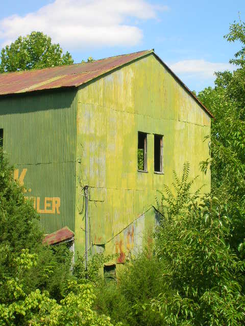
Hickory Flat Schoolhouse ( Izard County) Old School/Church House at Union (Fulton Co.)
A member of the EIC crew, an old hippe-from-California-turned-hillbilly-from-Arkansas, and I spent the past two mornings in the eastern and northern parts of the county where I got these great shots.
The stone church and the old store building are both located in Salem, our neighbor to the north in Fulton County. The old schoolhouse at Union, Arkansas, is located just north of the Izard County line along the way to Salem.
We happened along at the right time to get this MASSIVE blacksnake on video. It was at least six-feet long and very likely slightly bigger than that!


Saturday, August 05, 2006

Thursday, May 25, 2006
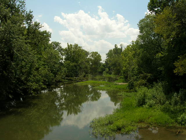
Strawberry River/Franklin
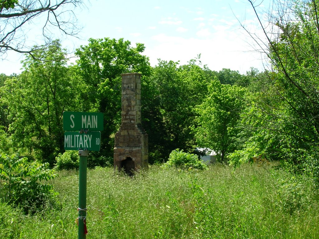
The Old MIlitary Road was used to move native-Americans during the infamous "Trail of Tears". There is an interesting article about the early roads in Arkansas that includes a brief mention of this road which ran from Batesville to Norfork. Here's a map detailing the various routes used to relocate Native Americans. Benge's route is the one that runs through Izard Conty.
Here is paragraph from W.E. McCLeod (1869-1951)
"The other branch of the Military road extended westward from Jackson to Northfork and on to Batesville and Ft. Smith. This was a road used ln the removal ot the Indians to the west, and by immigrants into Northwest Arkansas. It is another road called the Military road, though it was only a branch of the main road, What a wondertul story these old roads could tell if they could speak. It would be a story of silent, sorrowful Indians as they treked their way to a land they knew not, and of thousands of hope- tul immigrants as they wended their way in canvas covered, ox drawn wa- gons, on horseback and on foot to make new homes in the south and west. The roads described were great immigrant routes, particularly in northeast Arkansas; but there were several others a little later which were important in the settlement and development of this section of the state. Soon after 1836 a road was opened from Izard county eastward through Lawrence County, (then including Sharp) to Greene county, This road went by the new towns of Smithville and Powhatan, where there was a fine ferry across Black River. Smithville was and is situated on this road where it intersected the branch of the Military mentioned above, and its favorable location accounts for its continuance to this day as one of the best off railroad towns in the country, The two roads are now graveled highways."
I'll have some shots of the Strawberry River eventually.
Subscribe to:
Posts (Atom)